Discovering Edinburgh Illustrated Map
Discovering Edinburgh Illustrated Map
Couldn't load pickup availability
Authors: Dominic Beddow & Collins Maps
Central Scotland | World atlases / world maps | Cartography, map-making & projections | Shopping guides | Travel & holiday guides | Museum, historic sites, gallery & art guides | Restaurant, cafe & pub guides | Street maps & city plans
Published on 6th June 2024 by HarperCollins Publishers (Collins) in the United Kingdom.
Sheet map, folded | 2 pages
205mm x 113mm | 270g

Explore new places with dependable maps from Collins.
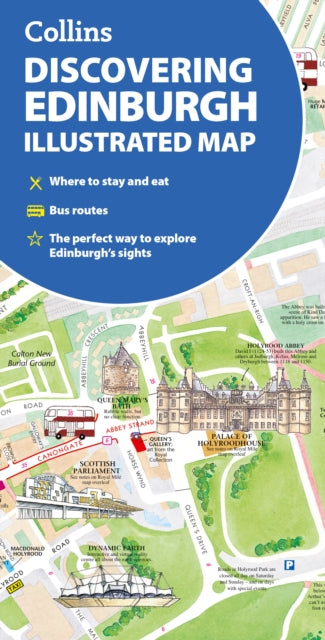
This brand new edition retains the delightful water-colour mapping, with individual paintings of all the main sights and landmarks.
This brand new edition retains the delightful water-colour mapping, with individual paintings of all the main sights and landmarks.
Popular areas at larger scale, hundreds of shops, restaurants, cafés and bars, comprehensive travel information and index.
This map includes:
Large-scale plans of the Castle, Royal Mile, Botanic Gardens, Leith and NewingtonShop-by-shop street maps of Princes Street, George Street, Victoria Street and the GrassmarketRailway stations, bus routes, taxi ranks and car parksHistorical and contemporary anecdotesSuggestions for day trips out of the cityComprehensive index
Area of coverage:
Covers the centre of Edinburgh from Inverleith Park in the north to The Meadows in the south, and from the Scottish National Gallery of Modern Art in the west to the Palace of Holyroodhouse in the east.
The perfect companion to Edinburgh for visitors and locals alike.